Perseverance Rover's Westernmost Selfie: Exploring Beyond Jezero Crater
NASA's Perseverance rover has been exploring Mars since February 2021, and on March 11, 2026 (the 1,797th Martian day, or sol), it captured its most westerly selfie yet. This remarkable image, taken at the edge of Jezero Crater's western rim, offers a stunning view of the rover's surroundings and its ongoing scientific mission. Below, we answer key questions about this achievement.
What is the significance of Perseverance's latest selfie?
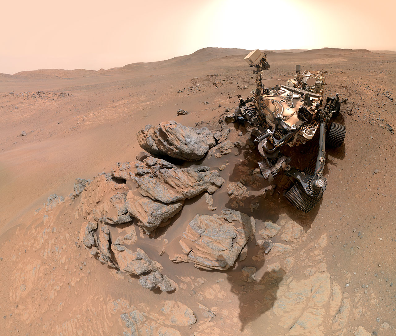
This selfie marks the farthest point west the rover has reached since landing. It was taken on sol 1797 during a push beyond Jezero Crater, providing a unique perspective of the crater's western rim in the background. The image also showcases the rover's work at the "Arethusa" rocky outcrop, where it created an abrasion patch to study the rock's composition. This selfie is not just a portrait; it's a scientific document that highlights the rover's progress and the diverse Martian terrain it's exploring.
How was the selfie created?
The selfie is a composite of 61 individual images captured by the WATSON camera, located on the end of the rover's robotic arm. After the images were taken, they were transmitted back to Earth and stitched together to create the final panorama. This process allows the rover to capture itself and its surroundings in high detail, even though the camera is attached to the arm and can't take a single wide shot. The result is a seamless image showing Perseverance next to the Arethusa outcrop.
What does the selfie show?
The selfie features Perseverance with its mast pointed toward the "Arethusa" rocky outcrop, where a whitish circular abrasion patch is visible. In the background, the western rim of Jezero Crater rises on the horizon. The image also includes a version called Figure A, where the rover appears to be looking directly at the camera, and animations that simulate the rover looking up and down. Together, these visuals provide a comprehensive view of the rover's location and activities.
What is the WATSON camera and how does it work?
WATSON stands for Wide Angle Topographic Sensor for Operations and eNgineering. It is a camera mounted on the end of Perseverance's robotic arm, primarily used for close-up imaging of rocks and surface features. For selfies, the rover positions the arm to take multiple overlapping images, which are later stitched together on Earth. WATSON was built by Malin Space Science Systems (MSSS) in San Diego and is jointly operated by MSSS and NASA's Jet Propulsion Laboratory (JPL).

What is the SHERLOC instrument and its connection to WATSON?
SHERLOC (Scanning Habitable Environments with Raman & Luminescence for Organics & Chemicals) is a spectrometer that searches for organic compounds and minerals. WATSON is part of SHERLOC, serving as its context imager. While SHERLOC analyzes the chemical makeup of rocks, WATSON provides high-resolution images of the same targets. Together, they help scientists understand the Martian environment and look for signs of past microbial life.
How does Perseverance take a selfie?
Perseverance's selfie-taking process involves several steps. First, the rover positions its robotic arm to hold the WATSON camera at a specific angle. Then, it captures a series of images by moving the arm to cover the rover body and the surrounding area. After the images are sent to Earth, they are stitched together using software to create a panoramic selfie. A video explaining this process is available from NASA. This method allows the rover to document its condition and surroundings without a dedicated selfie camera.
What is the "Arethusa" outcrop and why was it studied?
"Arethusa" is a rocky outcrop located at Perseverance's westernmost position. The rover used its abrasion tool to create a circular patch on the rock's surface, revealing fresh material beneath the dusty exterior. This patch allows instruments like SHERLOC and PIXL to analyze the rock's composition and mineralogy. Studying such outcrops helps scientists understand the geological history of Jezero Crater and the surrounding region, including whether ancient water or life could have existed there.
Related Articles
- How to Analyze and Reform the Federal Budget's Fossil Fuel Subsidies and the Capacity Investment Scheme
- The Shifting Lights of Earth at Night: Insights from NASA's Black Marble Project
- Decoding Failures in LLM Multi-Agent Systems: A New Automated Attribution Approach
- Satellite Analysis of Cyclone-Induced Landslides: A Case Study of Papua New Guinea
- Testing a Regenerative Fuel Cell System for Lunar Energy Storage: A Step-by-Step Guide
- A Step-by-Step Guide to Using the Keto Diet for Mental Health Support
- Climate Change's Toll on Agriculture: Why Food Insecurity Now Threatens All Nations
- Elite University Domains Hijacked to Deliver Porn and Malware